
Johnston ZIP Coverage Ledger
Official city and USPS sources verify one current Johnston ZIP code. The same sources also document a former code for part of northwest Johnston. The table keeps current delivery evidence separate from historic clues and Census geography.
| ZIP | Area Covered | Post Office | Research Note |
|---|---|---|---|
| 50131 | Current Johnston delivery identity | Johnston Post Office | Verify each full address through USPS |
| 50131-1291 | Post-office location only | 5874 Merle Hay Road | Not a universal ZIP+4 for the city |
| 50111 | Historic northwest Johnston delivery clue | Formerly labeled Grimes | Changed to 50131 on August 22, 2017 |
| ZCTA 50131 | Census statistical approximation | Not a postal facility | Not a parcel or delivery boundary |
No other active Johnston ZIP was verified in the official city and USPS material inspected. That gap should not be filled with a code borrowed from a nearby city. For a specific residence, the full-address result is stronger than a citywide list.
Johnston's 2017 ZIP Change
Northwest Johnston once carried the Grimes 50111 postal line. An official city notice says affected addresses changed to Johnston 50131 on August 22, 2017. USPS handled both codes for twelve months. This is a genuine local quirk, not an error that should be erased from an old record.
A deed, voter-related letter, newspaper item, or directory dated before the switch may correctly show 50111. Preserve that original city line and publication date. Then add the 2017 city notice and a current USPS address result as the bridge to modern 50131. Do not describe 50111 as a timeless Johnston equivalent or as a current city-boundary marker.
Date first. A northwest Johnston address with 50111 can be historically correct even when today's standardized postal result uses 50131.
Search Johnston ZIP Code Modes
The USPS ZIP Code Lookup offers three modes. Pick the mode that answers the question, and save both the input and lookup date. By Address is the best test for one residence. By City and State discovers delivery labels for Johnston. Cities by ZIP shows the place names USPS associates with a code, but it cannot settle municipal limits.
| USPS mode | Core inputs | Best use | Limit |
|---|---|---|---|
| By Address | Street, city, state; company optional | Standardized ZIP and possible ZIP+4 | Postal result, not parcel ownership |
| By City and State | City and state | Coverage discovery | May show more than one convention |
| Cities by ZIP | Five-digit ZIP | USPS place labels | Does not prove city limits |
Keep directional prefixes, apartment or unit data, and rural-route wording when those details appear in the source. Test Johnston and the exact street address. Removing part of an address too soon can create a different standardized result.
Find Johnston Residents by ZIP
A ZIP code directory narrows the search; it does not finish it. Official systems use ZIP in different ways. The voter form combines it with a name, house number, and birth date. The state registry accepts ZIP as one search field. USPS returns delivery data. The assessor supplies situs and parcel context.
- Run the exact address through USPS By Address and save the standardized result, ZIP+4, mode, and date.
- Compare the result with the Polk Assessor situs and mailing fields. Save the parcel number when the address matches.
- Use the Iowa voter lookup only for an individual search with all required identity fields. Treat the response as election data.
- For a wider lawful research need, use the official voter-list request and select the smallest useful jurisdiction or geography.
- Once the ZIP narrows to a street, use the Johnston street directory for the address-keyed record chain.
A ZIP filter can return a group that crosses the city line or reflects a different update date. Verify the person or parcel in a second source. Never infer Johnston residence from the five digits alone.
Johnston Post Office Evidence
The USPS Johnston Post Office record lists the facility at 5874 Merle Hay Road, Johnston, Iowa 50131-1291. Its published hours are 9:00 a.m. to 5:00 p.m. weekdays and 9:00 to 11:00 a.m. Saturday; the listed phone is 515-303-8224.
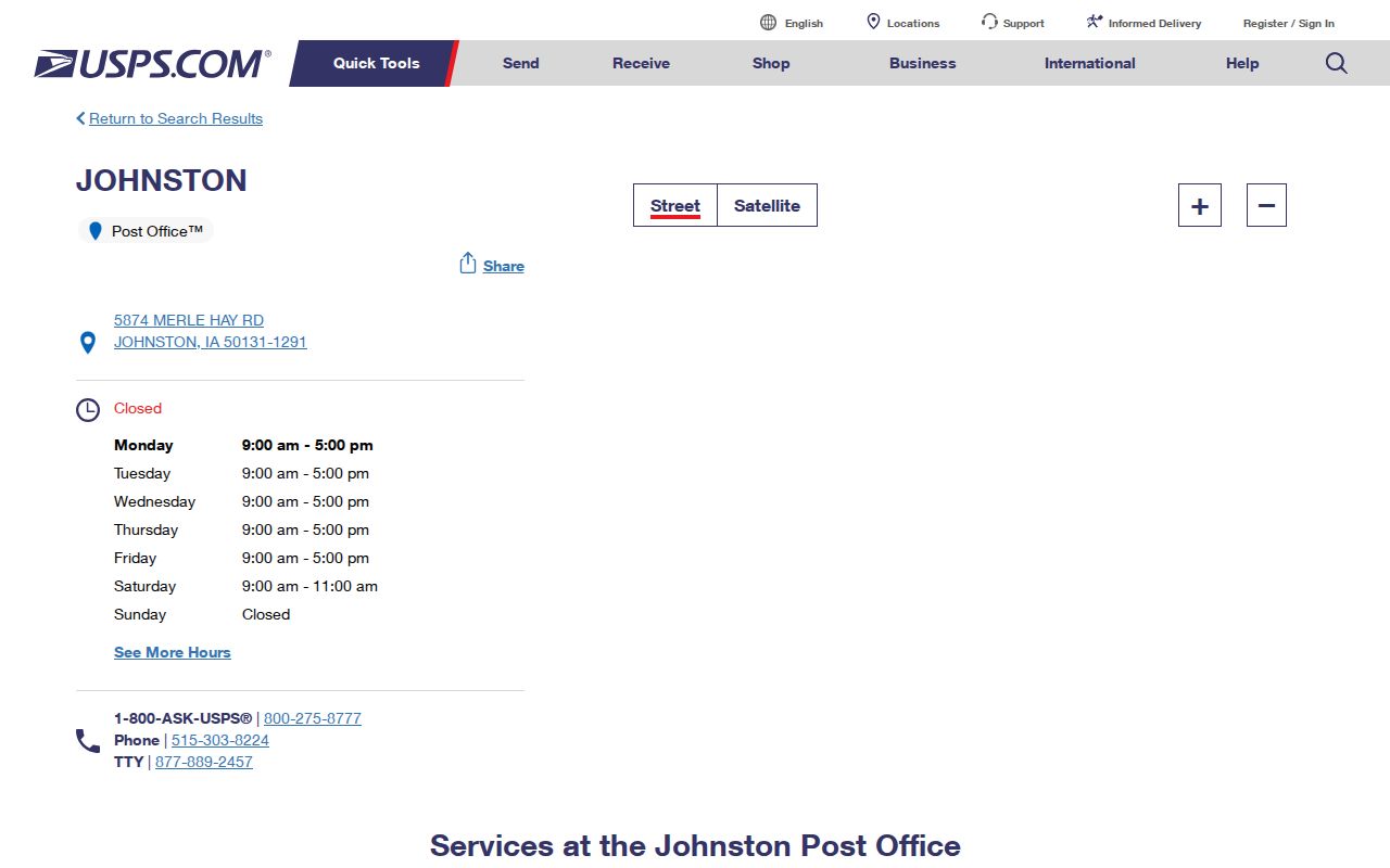
Post-office evidence and address evidence answer different questions. Use the facility page for published office information, then run a separate By Address search for the residence under study.
Johnston ZIP and City Limits
ZIP delivery areas, Johnston corporate limits, and assessor situs are separate geographies. The distinction matters near the city edge and in land added through annexation. A postal result answers how mail is routed. A city map answers whether the parcel lies within municipal limits. An assessor card identifies the taxed parcel and its situs, which means the physical location used for assessment.
- ZIP and ZIP+4
- A ZIP identifies a delivery area. The extra four digits narrow a delivery segment for one standardized address.
- PO-box ZIP
- A code or ZIP+4 used for post-office boxes rather than ordinary street delivery.
- Unique ZIP
- A code assigned to one high-volume organization. None was verified for Johnston.
- Carrier route
- A USPS delivery path, not a city ward, neighborhood, or parcel boundary.
Compare the USPS result with the current city map and Polk parcel data. For historic northwest records, add the 2017 postal notice. No official year-by-year Johnston postal-boundary map or carrier-route history was located, so exact historic edges may require an archive or USPS inquiry.
Johnston ZIP Population Numbers
The 2020 Census counts differ because the units differ. Johnston's city count was 24,064. The Census ZCTA 50131 profile displayed 24,434. A ZCTA, or ZIP Code Tabulation Area, is a Census approximation built for statistics. It is not the USPS delivery area and does not redraw the city border.
This comparison is useful only when each number keeps its label. Do not blend them into one Johnston population figure or use either count as a resident roster. For newer city scale, Census QuickFacts estimated 25,065 people on July 1, 2025, but that later city estimate should not be compared as if it were a 2020 ZCTA count.
Note: Write “Johnston city,” “USPS 50131,” or “ZCTA 50131” beside each figure so readers can see which geography produced it.
Johnston ZIP Filters in Records
The Iowa voter lookup and Iowa Sex Offender Registry both expose a ZIP field, but they serve different public purposes and return different kinds of evidence. The voter form requires first and last name, numeric house number, ZIP, and full birth date. It checks one supplied identity and address combination. A blank result can follow from a move, spelling, wrong date, or confidential Safe at Home status. It is not a public list of everyone associated with 50131.
The registry permits a ZIP search as part of a status-specific public system. Results must remain labeled as registry information with the search date. A ZIP match does not establish that every listed address falls inside Johnston corporate limits, and registry status is not interchangeable with a court disposition. When a case question arises, verify it through Iowa Courts Online and the Polk Clerk rather than inferring the outcome from a map point.
Polk voter-list data follows another route. The Secretary of State request process offers jurisdiction choices and voter-status options, with use restricted to voting, a genuine political purpose, bona fide research, or official government work. Commercial use is barred. Requests can be made through the published form and delivered in approved formats; Polk election staff also provide in-person, phone, email, mail, and fax channels. Save the request certification and delivery date because a list is a dated export, not a live map.
A strong ZIP-based note names the system beside the claim: “USPS delivery result,” “assessor situs,” “voter-system response,” or “registry ZIP result.” It also records the date and the fields used without exposing a private birth date. That wording keeps postal geography from becoming an unsupported statement about identity or residence.
Resolve a Johnston ZIP Mismatch
When the online result fails, keep the original address and move through the access channels. Run all three USPS modes, check the official post-office page, compare the Johnston street map, and inspect the Polk Assessor situs. City GIS and E911 staff maintain address and map data and can route a local addressing question. For an older record, Johnston Public Library, local historical material, city notices, and archived directories can preserve the postal wording used at the time.
Phone or visit the post office for a current delivery issue. Contact the City Clerk or GIS staff for city records and map context. A Chapter 22 request can seek a specific city or county record, but it should name the custodian, record type, date range, and format. No complete historic ZIP+4 range list was found, so do not invent one from scattered results.