
Walk a Johnston Street Directory from One Address
Ownership and residence are separate questions in Johnston. The Polk County Assessor identifies a parcel and owner, while election data or a dated directory may support a resident link. A sound street directory keeps each claim tied to its source and date.
- Run the address through Polk County Assessor search and save the parcel, situs, mailing address, and legal description.
- Browse the road and nearby parcels through Polk County GIS or Johnston mapping resources.
- Use Iowa voter lookup only when the required name, ZIP, house number, and birth date are already known.
- Pull the latest deed from Polk Land Records and follow its earlier instrument reference.
- For past associations, test the library street guide and alphabetical name section in nearby directory years.
Save the exact query and access date. When sources conflict, the legal description and parcel number offer a firmer bridge than a guessed street spelling.
Johnston Records That Work by Street
No source is a complete Johnston street directory. Each custodian answers one part of the question, and the route changes with the record's date.
| Address source | Official keeper | What it establishes | Access route |
|---|---|---|---|
| Parcel roll | Polk County Assessor | Owner, situs, mailing address, parcel, legal description | Online portal or county office |
| Map context | Polk County GIS and Johnston Community Development | Road, parcel, E911, city-map, and infrastructure context | Online maps or City Hall data request |
| Recorded instruments | Polk County Recorder | Parties, kind, date, references, and deed chain | Online from 1992; Iowa Land Records; counter; Imaging/Microfilm |
| Voter data | Iowa Secretary of State and Polk Election Office | A supplied identity/address match or permitted requested list | Lookup, certified request, office, email, mail, phone, or fax |
| Building reports | City of Johnston | Dated permit and development evidence by address | Posted reports or Chapter 22 request |
The parcel number joins the assessor and map to the Recorder trail. A printed address connects a directory or permit report, but it should never be stretched beyond its publication date.
What a Johnston Street Directory Leaves Private
A property roll identifies an owner, not every occupant. Mailing data may point elsewhere, and Iowa's individual voter lookup is not a street roster. Safe at Home can place an eligible survivor behind a substitute address. A missing result can reflect timing, spelling, migration, or lawful confidentiality.
Lawful use. Use Johnston address records for lawful personal, family-history, property, and civic research. Never use them to watch, stalk, harass, intimidate, or harm someone.
Commercial data can be broad yet stale and unverified. Official rolls are narrower, but they identify the keeper, field, and date. Silence is a limit, not permission to infer a household.
Polk Assessor Fields for a Johnston Street Search
The Polk County Assessor property search supports more than a single exact-address query. Use these controls when a full entry fails, then preserve the result's parcel number, situs, mailing address, and legal description.
| Search control | Portal rule | By-street use |
|---|---|---|
| Street Address | Full or partial text without city, state, or ZIP | Begin with a Johnston site |
| Owner name | Last and first name fields | Test a possible owner |
| Plat | Subdivision or plat text | Group related lots |
| Parcel or geoparcel | Several slash, dot, dash, and plain-number formats | Return to stable land identity |
| Condition and value | Equality, comparison, and between choices | Narrow a result set |
| Range and wildcards | Colon or two dots for ranges; percent and underscore wildcards | Browse part of a street |
| Unit notation | #, Suite, Ste, Unit, Apartment, or Apt | Separate multi-unit sites |
The county announced a 2026 move to Vanguard Appraisals while retaining search service. Record the access date and visible field labels because the interface can change.
Address Terms Behind the Johnston Street Directory
Keeping four terms distinct prevents a plausible street match from becoming an unsupported claim.
Parcel: the assessed and mapped unit of land, tracked with a parcel identifier.
Situs address: the parcel's physical location, which may differ from the tax mailing address.
Plat: a recorded map or description that divides land into lots, blocks, or streets.
Criss-cross directory: a directory arranged by address. No separate Johnston reverse run was verified, so a regular street guide is only a limited substitute.
USPS delivery, E911, historical publication, voter, situs, and mailing forms answer different questions and should remain separate fields.
Johnston GIS Maintains Current Street Addresses
The Johnston GIS and Mapping page identifies Community Development as the source for E911 maps and addresses, city maps, street maps, Iowa DOT resources, and infrastructure inventories. Map or data questions route to 515-727-7778 or City Hall at 6221 Merle Hay Road.
The captured city page shows the address-maintenance role beside Johnston's mapping work.
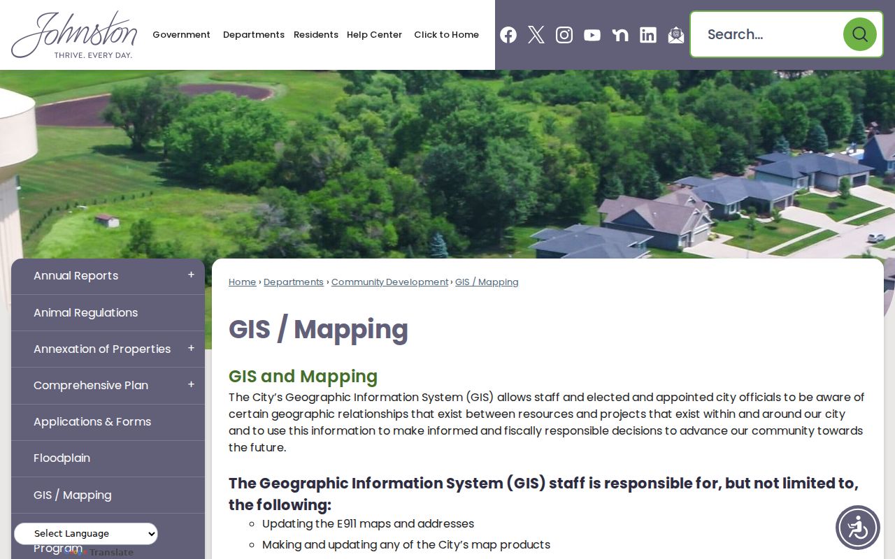
This layer checks a current label and mapped location. A deed or assessor legal description remains the stronger land identifier.
Take a Johnston Parcel into Polk Land Records
Save the parcel number and legal description before searching deeds. Polk's online real-estate index runs from 1992 to the present. Search the current owner as a grantee, inspect the latest instrument, note its parties, kind, date, file number or book/page, image count, and earlier reference, then repeat backward.
The name form exposes Last/Firm, First, Middle, Title, Same Instrument, Party, Date, Index Type, Groups, and Kind. Remarks are marked "Not Warranted," so inspect the image. For older material, call Imaging/Microfilm at 515-286-3175, visit the Recorder, try Iowa Land Records, submit a Chapter 22 request, or consult State Historical Society of Iowa Polk deed and plat holdings.
A Johnston Street May Carry an Old Grimes ZIP
Northwest Johnston addresses changed from Grimes 50111 to Johnston 50131 on August 22, 2017, followed by 12 months of dual handling. An older directory, newspaper, contact field, or election item can therefore carry 50111 without falling outside Johnston's story.
Preserve the old form, then check the full address through USPS ZIP Code Lookup and compare it with the assessor situs and city map. Delivery ZIP, municipal boundary, and parcel location are not interchangeable.
Johnston Boundaries Reshape a Street Record Trail
Johnston incorporated in 1969, and its original limits excluded Johnston Station because of a three-mile restriction. A 1970 agreement with Urbandale enabled annexation. In 2018 the city added 1,461 acres, including Beaver Creek Golf Course, a Navy training facility, part of Camp Dodge, and six undeveloped parcels.
Older records may use Beaver Creek Settlement, Ridgedale, Huntsville, Johnston Station, rural-route terms, or a nearby postal city. The official March 2026 map supplies current context only. No complete public street-renumbering ledger was located, so resolve a failed label with plats, the Auditor road atlas, legal descriptions, directories, newspapers, and Johnston GIS staff.
Read a Johnston Directory Street Guide Carefully
Without a dedicated reverse directory, locate an address in the publication's street guide, list the people or firms printed there, and verify each in the alphabetical section and the closest earlier or later available year. Des Moines Public Library's digitized 1866 to 1922 run is discontinuous, and Johnston may be filed as Johnston Station or a rural route.
The result is a dated printed association, not a complete block census. Preserve publisher, year, page, and exact abbreviation. The collection is covered more fully on the Johnston city directories page.
Johnston Building Reports Supply Address Events
Johnston posts monthly, year-to-date, and development-summary permit PDFs from 2013 through the current listed years. A report can add a dated construction or alteration event, but it does not prove that an owner occupied the site. Cite the report year and permit address.
Join the event to the assessor parcel, map, and recorded instrument. When posted reports are not enough, City Hall and the City Clerk route city-record requests under Iowa Open Records Law, Iowa Code Chapter 22.
Build a Reproducible Johnston Street Record Note
A useful by-address result needs enough detail for another person to repeat it after a portal changes. For the assessor, save the exact query, number of results, parcel number, situs and mailing forms, legal description, card or map link, assessment marker when shown, and access date. For GIS, keep the map URL, visible road and parcel context, selected layers, nearby routes, and layer date. The 2026 assessor-provider transition makes this recordkeeping especially important.
For a Recorder result, preserve grantor and grantee spellings, instrument kind, recording and instrument dates, file number or book/page, image availability, legal description, and any prior reference. Polk's sample result fields also include indexed names, other names, remarks, amount, and image count. A similar name alone does not complete the match. The parcel, instrument, date, and land description must agree.
For voter research, keep the search date and only the minimum fields needed to describe the result. Do not publish a full birth date or complete address in an example. A failed lookup can reflect spelling, a changed address, a protected record, or timing. If a permitted list is needed, retain the signed purpose certification, selected jurisdiction, list type, delivery date, and version. This disciplined note turns a Johnston street directory lead into a checkable source trail without exposing more personal information than the research requires.